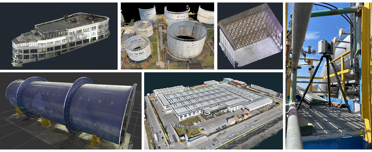
Prota delivers high-precision reality capture services to document existing buildings, industrial facilities, and infrastructure assets. Using advanced technologies such as 3D laser scanning, mobile LiDAR, UAV-based Lidar / photogrammetry, total station, and GPS surveys, physical environments are transformed into accurate digital datasets.
All captured data is processed and validated to ensure geometric precision and engineering reliability. The resulting point clouds and survey outputs provide a dependable foundation for analysis, design development, retrofit planning, and multidisciplinary coordination.
Our approach ensures that existing conditions are documented accurately, minimizing uncertainty and reducing risk in subsequent engineering phases.
top
Prota Mühendislik Proje ve Danışmanlık Hizmetleri A.Ş.